architecture

Designing a marker system for the next 10,000 years

"Permanent Markers Implementation Plan" is a project initiated in 2004 by the U.S. Department of Energy in order to provide a permanent record which identifies the location of nuclear waste repository and its dangers. The report is quite big and it's perhaps easier to peruse this shorter version, more focused on the design component.

This report described the task handled by one of the expert group made of an anthropologist, an astronomer, an archaeologist, an environmental designer, a linguist, and a materials scientist. The brief for them was basic:

"The site must be marked. Aside from the legal requirement, the site will be indelibly imprinted by the human activity associated with waste disposal. We must complete the process by explaining what has been done and why. The site must be marked in such a manner that its purpose cannot be mistaken. Other nuclear waste disposal sites must be marked in a similar manner within the U.S. and preferably world-wide. A marking system must be utilized. By this we mean that components of the marking system relate to one another is such a way that the whole is more than the sum of its parts."

This team work led to the definition of design guidelines, which, in turn, served as the starting point for several alternative designs for the entire site: "Shunned land...poisoned, destroyed, unusable", "Shapes that hurt the body and shapes that communicate danger":

Their conclusion is also fascinating:

"To design a marker system that, left alone, will survive for 10,000 years is not a difficult engineering task. It is quite another matter to design a marker system that will for the next 400 generations resist attempts by individuals, organized groups, and societies to destroy or remove the markers. While this report discusses some strategies to discourage vandalism and recycling of materials, we cannot anticipate what people, groups, societies may do with the markers many millennia from now. A marker system should be chosen that instills awe, pride, and admiration, as it is these feelings that motivate people to maintain ancient markers, monuments, and buildings."

Why do I blog this? I find the brief utterly curious: designing a system that would work for 10'000 years is an inspiring starting point in the age of planned obsolescence.

Facebook and spatial implications in Menlo Park

I'm generally not that interested in social networking sites per se... but this article in the WSJ sent on the Dr. Fish list caught my attention. It basically addresses the implication of Facebook upcoming move from Palo Alto (University avenue) to Menlo park on a new campus, which it is taking over from Sun Microsystems.

What's interesting in this article is simply the whole set of questions that is raised by this move. Some excerpts I found intriguing:

"The proposals will tackle how to refine the perimeter of the fortress-like campus, how to handle traffic as Facebook boosts staffing as well as how to build up housing and services such as stores in an area that currently doesn't even have a major grocery market. (...) At a city hall news conference Feb. 8 to announce Facebook's arrival, Mayor Richard Cline acknowledged there were debates to come. "We're going to talk about what we can do, what we can't do, we're going to talk about traffic, we're going to talk about transit, we're going to talk about tax money and we're going to talk about public benefit," he said. "We're going to have a fight and it's going to be loud." (...) Facebook doesn't require city approval to move in this summer, since it is taking over an existing (albeit largely empty) campus (...) Part of Facebook's interest in the community stems from its desire to replicate the college neighborhood feel it had in Palo Alto as a start-up. That won't be easy on the former Sun campus, which was once dubbed Sun Quentin by employees—a reference to the San Quentin prison—because it is separated by a major highway from the rest of the city. (...) "The real issue is density. If the intent is to increase density substantially, the problem is that the infrastructure for it just doesn't exist.""

Why do I blog this? This is just fascinating, especially when thinking of Facebook as a dual entity: a huge on-line community on one side and a company on the other side. I am wondering on how the culture developed by such a company influence the spatial/environmental/social decisions it will take in a place like this.

Brixton High Street: urban design for robots

An interesting project by Kibwe X-Kalibre Tavares:

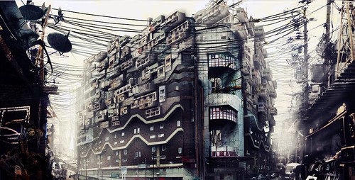
"These are a collection of images of what Brixton could be like if it were to develop as a disregarded area inhabited by London's new robot workforce. Built and design to do all the task humans no longer want to do. The population of brixton has rocketed and unplanned cheap quick additions have been made to the skyline.

Why do I blog this? designing of an urban environment (fictional or not) to accomodate robots seems to be a rather interesting brief. Surely some good design fictions can be built from there to reflect the possibilities of the future(s). The project blog is full of interesting material.

A visit to the Rolex Learning Center (EPFL)

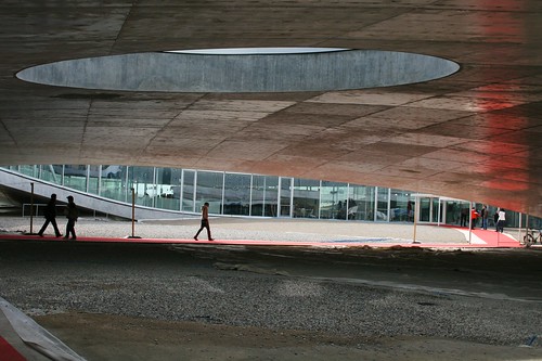
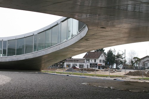
Rolex Learning Center (EPFL)Rolex Learning Center (EPFL) Rolex Learning Center (EPFL)

Some quick thoughts about the Rolex Learning Center that I visited yesterday afternoon at the Swiss Institute of Technology in Lausanne (EPFL). Designed by Sanaa, a japanese architecture firm, the building is an intriguing super large open space with a fairly low number of walls and partitions. This facility includes the school's library, the research lab where I've done my PhD research (Craft: Center for Research and Support of Training and its Technologies), the student and alumni association offices, an auditorium, two restaurants and a café. It's perhaps from above that the view is even more stunning. However, the most obvious way to see this is to take a flight to Geneva Cointrin (GVA) and have a proper wind that enables aircrafts landing route over Suisse romande instead of France's Jura Mountains.

The place is filled with natural daylight and only the restaurant and library, are equipped with refrigerating ceilings (which use cooled by water from the lake).
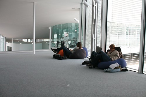
Rolex Learning Center (EPFL)

Given the interest here about user experience and weird insights concerning people, some details attracted my attention. Most people commented on the outside. As for me, it's some of the indoor elements that I want to describe.

Open space and Partitions

As described the architects in this interview with The Guardian:

""The main aim is to make a space for people to stay together," says Sejima, "but where you can also have some privacy." The design reflects their idea of "softening boundaries". She opposes "programmes that say a room is a place to learn and a corridor is a place to relax. I do not think that is a way to learn. Sometimes, activities become continuous. You might have a coffee outside the classroom and change your opinion." The role of architecture is to suggest ways to use the space, rather than to prescribe. Nishizawa pushes the analogy with landscape: "When people find valleys, they tend to settle there and build villages. When they find a hill, they like to build a beautiful cafe on the hill. When they find slopes, they cover them in terraces." In the same way, they think their artificial hills will prompt different kinds of occupation: "We hope students can find nice places for themselves." "

It's indeed interesting to confront the architects' intents to current behavior: Rolex Learning Center (EPFL)
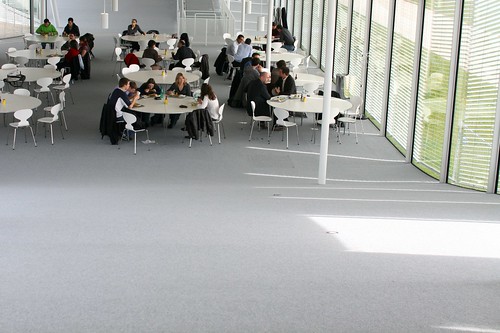
Although the partitions are not so present in the designers intents and in the building itself, there are still "invisible" boundaries, as attested by this map displayed on the library table. There are clear indications of areas where certain behavior are acceptable or not. Rolex Learning Center (EPFL)

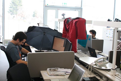
Another intriguing example lies in the usage of personal space. See for example how this Phd student re-created his bubble with "temporary walls". The coat is interesting for that matter but the use of the umbrella is even more striking. Daylight is so important here that sometimes yes, people needs a bit less light to look at the numerous displays present on everyone's desks.
Rolex Learning Center (EPFL)

Steep curves

In addition, the surface of the floor and the ceiling is both elegant and curious. Also, the curves are actually quite steep as shown by the examples below. There is therefore a need to have particular devices to bring people up and down. I do not know the designers' intents here but the Alpine context around (think about the Mont Blanc on the opposite side of the lake) turns the indoor walking experience into something closer to natural structures.

Rolex Learning Center (EPFL) Rolex Learning Center (EPFL)

Signage

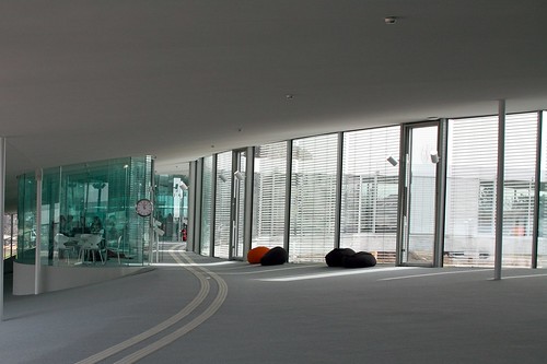
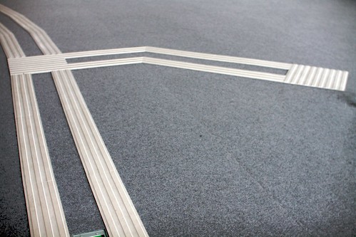
The use of what I would call "smooth podotactiles" is remarkable as well. These plastic lines on the floor aims at guiding people to the main locations of the Learning Center. Because of the curved floor, these elements sometimes give a very particular impression. It is as if perspective has been added to the interior architecture.
Rolex Learning Center (EPFL) Rolex Learning Center (EPFL)

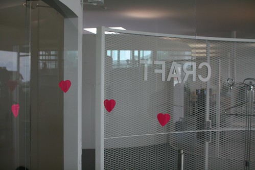
A funny aspect of signage is also the post-its people have started to put on glass walls... because of their translucence, it seemed that some folks bumped their heads into them. The repurposing of post-its was found as a solution to prevent this problem.
Rolex Learning Center (EPFL)

Time

Of course, it's impossible no to mention the importance of time in the context of this building. The main partner of this construction is Rolex (hence the name of the learning center) and it somewhat leads to the inclusion of clocks here and there. They act as physical marker of the presence of time. It's a library where people work so it's indeed relevant for students and researchers. But clocks also have another role here. if you look at the picture below, it shows time in different cities (the future is urban right?): San Francisco, Boston, Tokyo, etc. to remind people that the "outside" is as important as the inside. Perhaps it's also meant to represent a direct connection to other "knowledge places" which are relevant in this era of cognitive capitalism.

Rolex Learning Center (EPFL)

Ceiling signage

You can write under the bridge! In general, ceilings are not so common place to put signage on. Which is why I found interesting to encounter this sign "L'Europe" (the name of this plazza in Lausanne) placed on the surface that is under the bridge where people walk to the subway station.

R-O-B mobile robotic fabrication unit

Not exactly the type of self-constructed architecture described by Bruce Sterling in "Distraction" but very close: R-O-B by Gramazio and Kohler from ETH Zürich:

"R-O-B extends the traditional prefabrication process of construction: the robot leaves the protected environment of the production hall and ventures out to the building site. Housed in a modified freight container, the R-O-B mobile fabrication unit can be used anywhere in the world. It combines the advantages of prefabrication – precision and consistent high quality – with the advantages of short transport routes and just-in-time production on the building site. Furthermore, the mobile fabrication unit is not restricted to a predefined manufacturing process or a particular building material. Making use of computer methodologies in the design and fabrication process allows for manufacturing building elements with highly specific forms, which could not be build manually."

Why do I blog this? curiosity towards the application of robotics in architecture. The thing recently participated in the construction of this Wall presented at the Venice Biennale

"A Social Dimension for Digital Architectural Practice" by Chris Speed

Chris Speed's PhD thesis seems very relevant for people interested in architecture and digital technologies, and more specifically the notion of "social navigation":

"Through a literature review of the introduction and development of digital technologies to architectural practice, the thesis identifies the inappropriate persistence of a number of overarching concepts informing architectural practice. In a review of the emergence and growth of ‘human geography’ it elaborates on the concept of the social production of space, which it relates to an analysis of emerging social navigation technologies. In so doing the thesis prepares the way for an integration of socially aware architecture with the opportunities offered by social computing."

As the author describes in his conclusion, the thesis:

"...adressed the research question by analysing how digital architecture had positioned itself without a social agenda through its adoption of a split model for time and space. It went on to discuss the way in which human geography, through an identification of social agency in the production of space, has demonstrated how a combined approach supports many new models for understanding experience. It introduced social navigation as a contemporary form of social computing that offers the methodological techniques for supporting the construction of digital architecture. The author's own art and design practice was reflected upon, as it was through this that a methodology was developed and applied to the large-scale design project, and evaluated through a substantial ethnographic study. "

What's interesting in his work is the different projects he designed to illustrate his theoretical claims. One my favorite is certainly the Random Lift button that I already mentioned here.

(Photo by Chris Speed)

Why do I blog this? I only had a glance to the whole thing because there's a lot of material in there but it looks like an impressive attempts to put together different theoretical bodies and design projects in a very coherent and relevant way to address the relationship between digital and physical space.

Hertzian space and architecture

Obviously related to my talk about the invisiblity of ubicomp, Kazys Varnelis wrote an intersting A+U paper that you can find on his blog about how we live in "Hertzian space" the cloud of electromagnetic radiation that surrounds us and wonder how architecture that actively engage Hertzian space would look like:

"Two examples tentatively suggest ways in which urbanism might take into account our radically changed environment. The first of these forces us to confront the invisible forces in our environment. The second proposes to warp the very fabric of the city. (...) In Osman and Omar Khan’s project “SEEN-Fruits of Our Labor” the designers crafted (...) acrylic screen, (...) The designers set out to foreground questions of labor in the United States by asking members of three groups crucial to the Silicon Valley economy—technology workers, undocumented service workers and outsourced call center workers—the question “What is the fruit of your labor?” The Khans displayed the responses on the screen via a grid of infrared LEDs. (...) viewers saw a message that otherwise existed only in Hertzian space, invisible to the eye, on their camera screens (...) Robert Sumrell and I produced the second piece, “Windows on the World” (...) Windows on the World proposes to site multiple portals in multiple cities to create a true world planetary network, based not on capital and planning but on chance encounters. Remixing Hole in Space and Guy Debord’s map of the “Naked City,” we propose a telematic dérive, with each portal becoming what the Situationists called a plaque tournante, a center, a place of exchange, a site where ambiance dominates and the power of planners to control our lives can be disrupted. "

Why do I blog this? documenting interesting examples of the interlinkage between the digital and the physical, as usual.

Yet another incredible architecture: Lingotto rooftop

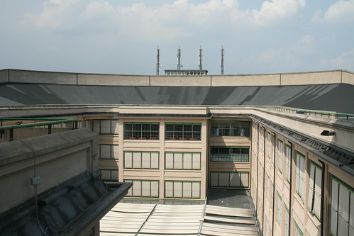
Last week in Torino, Italy, I spent some time in the Lingotto building which was a huge FIAT car factory built from 1916 and opened in 1923. A place Le Corbusier called it "one of the most impressive sights in industry", and "a guideline for town planning". It's now a complex, with concert halls, theatre, a convention centre, shopping arcades and the hotel where I was staying.

Lingotto rooftop test track

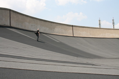
The most impressive part if of course the rooftop track for testing cars. I ain't a car enthusiast by any means but that piece of architecture is very intriguing to observe. Especially, if you consider how it has been pointed out as an "example for the future". According to Jonathan Glancey in Architectural Review:

"The Futurists claimed that 'Fiat Lingotto was the first built invention of Futurism', although Matte-Trucco (1869-1934) was a level-headed, if adventurous, structural engineer, much indebted to Albert Kahn, and very much not a Futurist. His famous reinforced-concrete factory boasting a test-bed race-track on the roof, and now remodelled as a civic, commercial and arts centre, by Renzo Piano (AR November 1996), was designed very much in line with Giovanni Agnelli's curt instruction: 'You will not be allowed to enter the Biennale Exhibition. You must have no aesthetic concerns. That's how you must work for industry.' Matte-Trucco did not question his FIAT boss. The result, in any case, was a masterpiece, a building that was all but mythical before it was completed."

Lingotto rooftop test track

Wandering around the track is still a curious experience, especially when the weather's very hot. The ground looks like a skateboarding grip and the curves are quite steep as attested by how Mr. Greenfield is taking care not to slip:

Lingotto rooftop test track

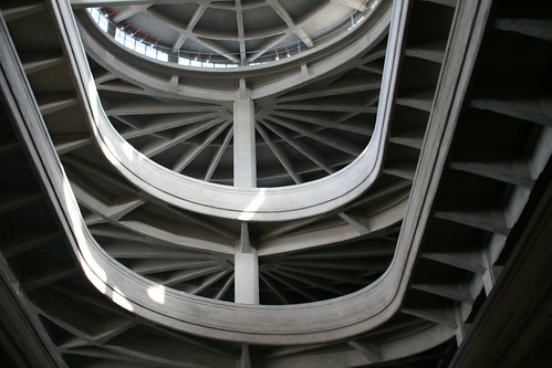
Moreover, the structure is not only about a flat rooftop... there is also the path to get the car on the very roof: Lingotto rooftop test track

Why do I blog this? Like the Atomium, la Grande motte, this piece is inspiring to me as it exemplifies the avantgarde of the industrial era... the very presence of a tremendously big testbed as part of the architecture of the factory. Surely an interesting remnant from a past future, relevant to keep in mind when doing foresight research. Both in terms of urban and design research.

About pneumatic network

Pneumatic tubes and networks (as the one described in Boris Vian's novels) have always fascinated me. The name itself is gorgeous and it really looks like a strange vehicle. Although there are sometimes still use to transport cash and documents (transparent supermarkets pneumatics are intriguing), their usage has often stop or led to new possibilities: using tubes to put optic fibers to serve as internet infrastructure OR use both technology and pneumatic to vehicle paper documents which still matters in the 21st century. Also of interest is the mapping of pneumatic networks, see for instance the Paris network as shown in this article:

Why do I blog this? What is interesting here is not that you can get web-based remote control of an electro-pneumatic (nor the impact on net neutrality) but rather the existence and sometimes the resilience of this communication network. An old version of the "city of flow" sort-of.

The mechanical and electronic processes of Rotterdam

Having spend few days in Rotterdam makes me realize how this European city was a very interesting example of how the spatial environment can show heavily-visible signs of mechanical and electronic processes. And this, with different levels of interaction with regards to whom (or what) can influence this process. Let's pick up son pictures from my urban safari to illustrate this. Given its geographical location, Rotterdam has a big port. Therefore, you have plenty of devices that are related to how a port process material. Cranes for example are omnipresent but other devices are just remnants of past activities (and machinery to activate them) night crane

rotterdam machinery

rotterdam machinery

Still in terms of mechanics, bridges can be moved above canals (as in other cities in the Netherlands) and automation seems to be pervasive as indicated by those signs:

automation

But the environment can also be responsive, as attested by these red crane-like objects on Schouwburgplein square. Designed by West8, theses hydraulic cranes can be controlled by a panel situated on the square so that anyone can set the position of the light.

control your streetlamp (1)

Of course, this is also reflected in the architecture through very classical ambient displays such as the cladding of Renzo Piano's building for KPN Telecom. It acts as a giant billboard that displays patterns that change throughout the day.

KPN building

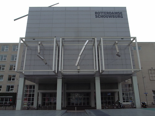
Back on Schouwburgplein square, very curious clock-like shapes are adopting dancing patterns in a somewhat ambient display-like ballet:

rotterdams schouwburg

At the individual level, there are also lots of examples of spaces from everyday life that becomes reliant on software (sort of what Kitchin and Dodge refer to as "code/space"). See for instance, the use of chipkaart (metro pass), the omnipresence of chipknip or how the inhabitants can use their cell-phone to deal with parking lots:

Phone for parking spot

That is even more intriguing when you encounters buildings whose shape adopt the form of machinery:

architecture in rotterdam

Why do I blog this? To some extent, I've been amazed by how wandering around in the city gave a feeling of "urban computing" at the lower level sense. As if there was some background sense of systems operating implicitly, quietly in a sort of ballet of movements and displays more or less controlled by the inhabitants. IMHO, it definitely exemplify the city as a dynamic process with changing shapes. My examples are of course not exhaustive, and some of them can also be found elsewhere but the combinations there seemed to be utterly explicit.

In addition, beyond "urban computing" notion such as location-based services or touch-interactions, it's rather when I encounter street signage about "automation" that I feel the digital city.

Motivations for defensive space

See below, three very relevant occurrences of how space is transformed in the 21st century. These are 3 examples of "defensive space" (aka "defensible space": architectural and environmental design used to reduce criminality by increasing field of observation and ownership) can be found next to where I live in Geneva. Wall

Defensive space

The first and the second one consist in covering the ground with concrete instead of the vague lawn that was used by drug dealers to hide their stuff. Note that the first move was (before putting concrete on that poor little tree) to break a mirror there so that drug deals would cut their hands when trying to get their heroine.

Defensive space

The third one is maybe less conspicuous: two pieces of steel has been put on the ground to prevent people to park their car (which nicely complements the yellow signage).

Why do I blog this? well although this is, sort of, environmental scannning 2 meters from home, it's definitely an important collection of signals that attest spatial changes. What does that mean for urban computing? I guess the next step when you're done with concrete, steel and broken mirror is to use electrons to prevent people from doing certain things.

Please see also the classical and sad anti-skateboard devices.

Sliding Friction: The Harmonious Jungle of Contemporary Cities

Sliding friction Fabien and I finally manage to release a near future laboratory project: Sliding Friction: The Harmonious Jungle of Contemporary Cities, a booklet that assembles photos and annotations we took here and there along our dérive through the many cities we lived in and visited. Sliding Friction is an attempt to showcase the curious aspects of contemporary urban spaces. Through 15 topics and 4 themes we focus our lenses on the sparkles generated by the many frictions between ideas, practices and infrastructures that populate cities. We hope to provide some raw food for thoughts to consider the city of the future. Do we want to mitigate, or even eliminate these frictions?

You can find it here as a pdf.

It's edited by Walabab editions, Designed by the (utterly fabulous) Bread and Butter, Preface by Bruce Sterling, Postface by Julian Bleecker.

Bamboos to reveal urban wifi

An intriguing new "urban computing" in the form of "communicating bamboo" has been developed by Orange Labs (A France Telecom R&D subsidiary). The point of such urban devices is to make WiFi hostpots more visible in public spaces and to access push-based services (mp3 download, vocal announces, etc.). Beyond the "((o))" signs that are starting to be used to show that there is wifi in the vicinity, this project is curious since it provides people with a more tangible artifacts. Related to this project is the idea of "Data Forest" in which the bamboo would be an anchor to digital services (hence a forest made of lots of bamboos). (Via fabien eychenne). For people who can read french, there is a video about this service here (presented by Emmanuel Mahé).

Why do I blog this? What is interesting here is the design of something tangible that would reveal that digital-yet-invisible services are available. A new sort of urban furnitures to some extent. I bet the designers also expect different uses to appear such as wifi picnic Nintendo DS group-play or other weird behavior yet to be described.

Graffiti removal selectivity

Seen in Lyon, France last week: removed

removed

Some graffitis removed, some other still there. How to establish a hierarchy of what should be removed? Is it the cost to remove big graffitis? the possibly-offensive content?

It gives an intriguing flavor of selectivity anyway. Stains are always curious as they are traces of activities and decisions taken by people.

How to kill an elephant path

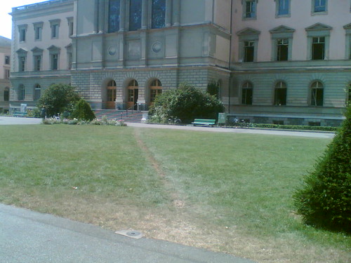
The last step of a neverending story (see previous episode here and when it all started). The tagline for this would be "how to kill a an unofficial route, a path that is formed in space by people making their own shortcuts“ July 2006: Elephant path in Geneva

February 2007: Please no

January 2008: dead elephant path

(the last picture shows the sign that say "please take care of the lawn, don't cross it please")

Why do I blog this? this is one of the most interesting aspect of urban life, how people's intents materialize ('desire lines' as one of the comment on my Flickr picture says) and how this is prevented by others forces. In this case, it's "to protect the lawn", which is a quite intriguing reason.

In addition, other things to think about: what's more efficient? the barriers or the warning sign? why isn't there any other elephant path starting on the other side (where there is no sign)? is it because you just get out of the building and it's acceptable to take a longer path?

Software tool to help citizens visualize their cities’ eco-efforts

The last issue of Metropolis featured an article about See-it, a software tool developed by "Visible Strategies" that helps Albuquerque citizens visualize their cities’ eco-efforts:

"See-it (short for Social, Environmental, Economic-Integration Toolkits) organizes citywide data into a live status report that the average citizen can quickly understand. At the center of the screen is a planet divided into three general areas of focus (ecosystems and agriculture, the man-made environment, and the economy and culture) and encircled by concentric rings of in-creasing specific ity (goals, strategies, and actions). If you’re interested in Albuquerque’s plans for its buses, for example, follow the “Greening Our Travel” goal to the “Vehi cle Efficiency” strategy, where you can read about the fleet’s ongoing conversion to alternative fuels. You’ll also find a graph that evaluates the plan’s progress (on track!) and a form to send feedback to a city manager. “It has forced us to take a good hard look at what data we have and how we measure our success,” says Danny Nevarez, who works at Albu quer que’s Environmental Health Depart ment."

Why do I blog this? there are lots of projects in urban computing that aims at revealing the invisible/implicit phenomena such as pollution, I am curious to see how city dwellers understand/use/employ such platforms. I quite liked that comment in the article: "Of course, the program is only as good as the data behind it, which the city itself provides" but I am more dubious about this comment by a user: "I want to be part of this. I want to be able to see whether I’m reducing my ecological footprint. And if I can’t do that, how can I relate to a government plan?

High bench in NYC

A quick glance at Fecal Face always lead to odd encounters. This time the crazy story that piqued my interest was the one of a high bench located on the Lower East Side of Manhattan, NYC. 10 feets in the air on metal stilts, this bench led to some head-scratching. Photos of the sculpture installation on the Lower East Side by Brad Downey and Mike Wrobel (found on the Fecal Face website).

Why do I blog this? Well, I find this sort of urban intervention intriguing, although weird at first. It certainly raises eyebrow but can also lead to some questions about our city environments. It seems that the bench has been removed by the city Department of Transportation and the NYPost asks boringly "is it art or just odd", which is definitely not the right implication to explore here. Fecal Face is clearly more relevant with that topic, proposing "Because Darwin was an elitist" as caption to the picture above.

Burglar vocabulary: location-based tagging

Last week in Brussels, I ran across this signs on the wall of that house: 165+ tagging

It quickly reminded me my parents' house on which we found the same marks. At that time, I remember the discussion with local police who told us that burglars use codes to annotate house. It's generally tags like this, with black chalk that express relevant information for them such as the one exemplified below (as shown in France's signs or Belgium's signs).

Simply put, it means that the marks on that belgian house correspond to: one kid, unoccupied house and planned robbery. Although it's weird to imagine only one kid in an unoccupied house, this is what the tag describe.

Why do I blog this? that's an interesting example of location-based annotation. It simply shows an intriguing signal of practices at stake in contemporary cities, a specific form of graffiti that aims at describing places to rob. It's a different form of spatial tagging not that explored by the locative media frenziness (for obvious reasons) that also represents the "transparent society" we're reaching. See here too.

In addition, it's curious from a collaboration POV, how this sort of tagging has been put in place by a group of people. At first glance, one can think burglary is a competitive practice, but it can go beyond that, as shown by the establishment of a common vocabulary.