Locative Media

More about the failure of location-based applications

Why LBS Applications Fail by David H. Williams is a good overview of issues regarding the problems of location-based applications. The author describes them at the 7 deadly sins... The Seven Deadly Sins of Location-Based Services. Source: E911-LBS Consulting 2006.

Regarding my own interests (the user experience of location-awareness), here are some excerpts that I found interesting:

Sin #5- Flawed Technical and User Design This is the failure to design toward the specific value proposition that is important to the target markets. Root causes include:

  1. Inattention to use cases of the service, the associated user interface, and the degree of personalization of the service
  2. Lack of creativity and innovation
  3. Not recognizing all the complexities involved in an LBS deployment: application setup, network and operational processes and systems, business operations and customer service
  4. Failure to adapt to realities of wireless device information presentation limitations

Sin #7 - Deficient Marketing This refers to the inability to get visibility in the marketplace. Root causes include:

  1. Taking a mass market approach versus niche product marketing
  2. A tendency to adopt a "Build It and They Will Come" mentality, while losing focus on the key value proposition(s)
  3. Not recognizing that customer education and giving the customer a sense of personalization is essential

Why do I blog this? I am gathering some thoughts for a talk about the user experience of LBS, the situation is not that different form 2 years ago. The article offer some relevant insights but here are some weird points (like "An example of a company that does a good job of identifying and targeting opportunities is Virgin Wireless, one of Richard Branson's companies. The company's vibrant marketing strategy, using billboards and the company's website, clearly targets teenagers with its "cool" slogans, brightly colored phones and simple plans."). If that's a good way to "identity and target opportunities"... :(

Do you need to lock your doors when you can track your belongings

In "Visionary in Residence: Stories" (Bruce Sterling), there are different short stories. In one of them, there is this email discussion about the design of a new category of product based on location-based technology:

If Al has the location and condition of all his possessions cybernetically tracked and tagged in real time, maybe Al is freed from worrying about all his stuff. Why should Al fret about his possessions any more? We've made them permanently safe. Why shouldn't Al loan the lawnmower to his neighbor? The neighbor can't lose the lawnmower, he can't sell it, because Al's embedded MEMS monitors just won't allow that behavior. (continued)

So now Al can be far more generous to his neighbor. Instead of being miserly and geeky "labeling everything he possesses," obsessed with privacy--Al turns out to be an open-handed, open-hearted, very popular guy. He doesn't even need locks on his doors! Everything Al has is automatically theft-proof--thanks to us. He has big house parties, fearlessly showing off his home and his possessions. Everything that was once a personal burden to Al becomes a benefit to the neighborhood community. What was once Al's weakness and anxiety is now a source of emotional strength and community esteem

Why do I blog this? because the excerpt describes a relevant possible consequences of location-based services that has not been explored so far in what I've read concerning their usage.

Location-based wristwatch in Second Life

I'm slightly underwater lately and I missed this news about location-tracker in Second Life:

SLStats comes in the form of a wristwatch, available in Hill Valley Square [in SL] in the Huin sim. Once you register with the service in-world, the watch "watches" where you go, tracking your location as you move around the world, as well as which other avatars you come into contact with. The information is used on the SLStats site to rank most popular regions (among SLStats users, of course), and to track how much time you've spent in-world, which you can view at a link like this one, which tracks Glitchy: http://slstats.com/users/view/Glitchy+Gumshoe.

Why do I blog tis? yet another location-awareness tool that I should quote in my dissertation about this topic.

Location-based annotation

Spotted this morning in Geneva:Salot

It's written "salot" with two arrows pointing at the windows (with means in fact "salaud", there is a bad typo, an english transaltion would be "asswipe").

What's the equivalent of this with a mobile social software for location tagging?

Track Santa

For geowanking kids: NORANDSANTA is a website that broadcast information about "santa tracking":

Detecting Santa all starts with the NORAD radar system called the North Warning System. This powerful radar system has 47 installations strung across the northern border of North America. NORAD makes a point of checking the radar closely for indications of Santa Claus leaving the North Pole on Christmas Eve.

It seems that they also use satellites, NORAD jet fighter and "santa cams" ("ultra-cool high-tech high-speed digital cameras that are pre-positioned at many places around the world"). See Paris below:

Why do I blog this? even though this leaves me sorta speechless, it's yet another XXX-tracking platform.

"Big games" and environmental space

Parsing tons of papers, articles, documents and pdf that I accumulated in the last few months, I ran across this article in Vodafone's Receiver: Big Games and the porous border between the real and the mediated by Frank Lantz. In this short piece, the author describes what he means by "big games", i.e. "Big Games are human-powered software for cities, life-size collaborative hallucinations, and serious fun". Some excerpts I find pertinent regarding my research: (picture from a project called “N8Spel” a project by Just van den Broecke, not cited in this paper but I quite like it)

Imaginary places, constructed from code, are now being represented not just as pixel grid windows into synthetic 3D environments, but mapped onto the actual 3D environments in which we live. Called "Big Games", these large-scale, real-world games occupy urban streets and other public spaces and combine the richness, complexity, and procedural depth of digital media with physical activity and face-to-face social interaction.

He then describes games such as ConqWest, Mogi Mogi, PacManhattan, Superstar, Can You See Me Now, Uncle Roy, Botfighters... And describes how the urge to use spatial environment as a playful space did not come out from the blue: children's neighborhood games (like Red Rover, hide and go seek, and kickball or Capture the Flag), Assassin/Killer game, skateboarding and Parkour, location-based art activities of the late 20th century, Live action role-playing. And those activities share some common purposes:

a desire to push game experiences beyond traditional boundaries of time and space. But there is another, complementary desire within conventional computer and videogames themselves. Over the last 10 or 15 years, these games have developed a profound obsession with play dynamics of 3D spaces, architecture, and environments. (...) In some ways, Big Games are a natural extension of this obsession with environmental exploration and social dynamics as gameplay subjects.

The author hence describes how mobile and ubiquitous computing technologies are a catalyst for big games creation. And finally, his thought about spatial practices are very interesting:

There is no longer a clear, well-defined boundary between the virtual spaces and interactive systems of our digital experience and the concrete, tangible aspects of our physical experience. Even as high-resolution computer graphics make the simulated worlds inside our computers more realistic, the actual world outside our computers is behaving more and more like data. (...) Regardless of the technology with which they are implemented, Big Games reflect a change in perspective brought about by mobile, pervasive, and ubiquitous technologies. Even Big Games that use chalk on sidewalks to make a citywide puzzle, or appropriate the archaic technology of payphones to make a game of urban tactics, are made possible by a shift in how we perceive our environment brought about by the new relationship between space and computing. (...) Whatever else they are, these games are primarily about connecting people – a way to reclaim public space as a site for a new kind of shared experience.

Why do blog this? because it gives a very good summary of "big games", which I am partly interested in my research (I use big games to study how people collaborate and use location-awareness features). On a different note, it seems that in the location-based/geowankin scene, the term "big" now receives more and more interest. See the "big here challenge" or how Fabien describes it (or even Matt Jone's video!). Finally, what the author stress in his conclusion (big games to reclaim public space), is exactly something Mauro and I wrote about three years ago in the following paper: To Live or To Master the city: the citizen dilemma or in this short pdf report I dropped on the web: Augmenting Guy Debord’s Dérive: Sustaining the Urban Change with Information Technology. The report only focuses on the use of LBS to foster new public space practices.

IHT on location-awareness

A good read in the IHT today: Wireless: Can mobile phones give you 'presence?' by Thomas Crampton is an article about mobile presence and location awareness. Though this topic received a fair amount of work in HCI research (my PhD diss is about that very topic), it is now more and more common to see it installed in the paysage (landscape). There are more and more systems that provides those features (both on desktop and mobile devices), and Jaiku (one of the system described in this article) is a relevant example for that matter. The article describe Jaiku, Plazes, Whereify... Some excerpts I found interesting about the design choices:

"Mobile phones have already become the hub for communicating by voice, pictures, video and Internet," said Mikko Pilkama, the director of multimedia services at Nokia. "Making phones aware of the context for all these activities is the next logical step." (...) Engestrom said that in setting up Jaiku, it became clear that the sharing of such data also raised privacy concerns. "We make sure that you as the user decide whom you share information with," Engestrom said, adding that individual users own all information stored on Jaiku's servers and can have it deleted at any time. Users also have the option of shutting off the system for privacy. (...) In addition to location-based advertisements, there could be charges for premium features like storing information over longer periods of time, or for sending SMS alerts.

But, of course, things are not simple (as reader of this blog might know):

"I worry that people attribute too deep a meaning to raw information," said Danah Boyd who researches social media at the University of Southern California in Los Angeles. (...) An added risk for the location-announcing services is that people might find themselves unable to break away from following friends or old lovers, Boyd added.

"The problem is that people really, really love stalking," Boyd said. "When you have just ended a relationship, it is not necessarily healthy to follow the exact location of your ex- lover minute-by-minute on your phone."

Why do I blog this? nothing really new under the sun here but it seems that Le Web3 (a conference held in Paris last week about technology usage) gave an opportunity to gather relevant people such as Jyri Engestrom and Danah Boyd to discuss their thoughts about LBS with an IHT journalist.

iFind: yet another friendspotting application

iFind is... "MIT's new location-based application for friendspotting", as they describe it (a project coordinated by François Proulx):

iFIND, a project developed at the MIT SENSEable City Lab, aims to improve social networking through some kind of digitally augmented serendipity. Using iFIND, you and your buddies can instantaneously exchange your locations on campus, talk to users nearby, and microcoordinate more effectively. If you are a geek, you will even be able to arrange meetings in real time using the group's center of gravity!

iFIND aims to give full control of location to the users. It is you who can choose, on a peer to peer basis, when to disclose your individual data and to whom.

Technically speaking, it's based on PlaceLab:

Your location is derived from the signals that your laptop's (for example) wireless card detects in its vicinity. Thanks to the high density of WiFi access points on the MIT campus, the software can compute your location accurately (we'd say within a few meters).

Urban juice: traveling system

It's kind of weird but after blogging about the "urban radar" I now ran across this Urban Juice project by Mine Danisman Tasar done at the Umea Institute of design (and Philips), which expands the notion of travelogue:

Prior to a trip, the modern nomad can not afford time to get acquainted with a new location. Besides that, it is challenging to be fully prepared for a new place. Urban Juice turns your travel experience into a fun activity by letting you get on-the-spot information and keep a log of your trip. By incorporating a social network of travelers, it provides you with the accumulated information.

There is a lot more to draw from the project report (beware! 23Mb pdf!). It explains the 3 modes of the projects: map (get location information, tag places, document your trip...), menu (travel planning), camera/augmented reality (take picture and document your trip in the camera mode OR get on-the-spot information in the augmented reality mode).

Why do I blog this? it's yet another system that aim at gathering traces of people's activity (like location tagging) to share them and create a filtering system about cities and travels.

Mobile LBS failures to meet expectations

Via Fabien: Mobile LBS Market by C. Desiniotis, J. G. Markoulidakis from Vodafone, and J-Fr Gaillet from NAVTEQ. The paper describes the mobile market of location-based applications (as opposed to web-based LBS for instance). Overall, it interestingly describes a more down-to-earth vision of the present situation:

mobile LBS were widely predicted to be the most promising “killer applications” in wireless communications. Today, most of these expectations are still not met and a significant delay in the market forecast has incurred. (...) Some of the most important reasons responsible for this turn are summarized as follows: Poor tracking performance. Current deployed techniques only allow a few hundred meters to a few kilometers accuracy. For the time of writing, very few handsets with advanced location capabilities (e.g. A-GPS) are available in the market while they are offered at high prices. Inherent customer perception issues. Privacy concerns arise as users are uncomfortable of feeling being watched. Security and location-aware phobia (both consumer and operator) prevent the users from adopting LBS as their usual habits. Low throughput mobile networks. The unavailability of high capacity networks (that would enable the transfer of multimedia content) is also considered a preventive factor for the wide adoption of LBS. The 3G networks launch and commercial availability was delayed. Further to this, only recently WLAN have started to take up and provide Internet services to crowded hot spots. Significant investment required. The initial investment and the high deployment costs (in terms of network equipment and marketing campaigns) imposed to MNOs and service providers did not justify the LBS development and market launch (at most markets). User adoption requires time. Taking as example other successful services, the market should be well educated in order to adopt a new service concept. Therefore, the initial low take-up phase of LBS was unavoidable. Not well defined business models. Taking into account that the emerging LBS introduced new service concepts, the business rules that would govern the value chain were not clearly defined among the business entities. This caused confusion in the involved players discouraging thus new initiatives. Unfriendly User Interfaces. Inherent difficulties of mobile devices e.g. for entering queries and displaying results (images, 3D maps, etc.).

Why do I blog this? because it lists very pertinent factors regarding problems about the mobile LBS adoption. I am mostly interested in the "Unfriendly User Interfaces" and I think the authors are maybe a bit too usability-centered and forget that LBS suffer from more holistic "user experience" problems: the failure to be deployed in correspondence with people's context and practices. And I surely believe that 3D maps won't help in the short run.

The forecast described are also intriguing expectations (based on a survey: “LBS 2006 Temperature Meter”, LBS Insight Industry Survey, Berg Insight, April 2006): I am not a fan at all of survey (especially in this case: we don't have any ideas about how it has been conducted) but it's like a barometer that gives the zeitgeist of the industry. Even though I find it pretty okay for the navigation and fleet tracking, I am curious about what is behind the figures for the location-based entertainment/games or information services. So far it was mostly prototypes with a low user adoption.

Having mobile presence or not?

Location-awareness of others, also expressed as a way to afford "mobile presence" has been supported by various interfaces. I did an tentative review in my phd dissertation with some categories of the types of interfaces and metaphors that are used to do so. The coming of applications such as Jaiku, Twitter (not to mention Dodgeball, Loopt or Wayn...) are examples of such. While I am interested in this and acknowledge that some systems are better and more interesting than others (Jaiku being my favorite for its very simple interface and the way location is captured/displayed), some people expressed criticisms over them. For instance, Janne Jalkanen says that:

There's just not enough benefit in telling everyone where I are and what I am doing so that I would actively use it. I don't mind the presence on the IM networks, because that's a necessity of those networks - you can't connect unless people are online - but mobile presence is useless, because everyone is online all the time anyway. And wasn't the whole point of cell phones that you would be no longer tied to a particular place or time or situation: you can call anyone anyplace anytime (barring some social conventions against calling people in the night)? However, I know there are tightly knit groups which love these kinds of applications, because they are living 24/7 closely anyway. But I am not sure I even want to know where my friends are. I think it would just make me bitter to know that they are out partying, traveling or otherwise enjoying themselves...

On his side, Niko Nyman have other concerns:

These services suffer from Metcalfe’s Law. They’re only useful if your contacts are using them as well. (...) the effort-to-benefit ratio is not good. I could see there being a benefit of knowing whether a friend of mine is available for interruption, or seeing where my friends are going on a Saturday night. But this assumes that a friend posts updates 24/7 about what he’s doing and where, yet I need that information for maybe one hour a week, possibly less. Realizing this, the 24/7 posting just seems like too much effort.

Then there’s that aspect of just keeping tabs on my friends’ updates “for fun and entertainment”. It could be just me, but watching what others are doing, described in three words, sounds like the world’s most boring reality show.

Why do I blog this? even though I don't necessarily agree with those comments (for example "mobile presence is useless, because everyone is online all the time anyway"), they are relevant viewpoints to discuss the importance of location-awareness.

Aaron Koblin's visualizations of commercial air traffic

I was recently stunned by Aaron Koblin's visualizations of commercial air traffic:

The following flight pattern visualizations are the result of experiments leading to the project Celestial Mechanics by Scott Hessels and Gabriel Dunne. FAA data was parsed and plotted using the Processing programming environment. The frames were composited with Adobe After Effects and/or Maya.

Why do I blog this? leaving aside the ecological problem of airtraffic, what is fantastic here is to see the overlap of flights, there is never a situation in which you have all those lines; geospatial traces up the air shows the history of flights, a kind of new layer in the atmosphere where people temporarily navigate. The movie is awesome.

BlueStates: sense social relationships and build a social network

BlueStates (see also here) by Mark Pesce, John Tonkin, an artwork presented at ISEA2006 that "art project which uses bluetooth - wireless networking found in many mobile phones and personal computers - to sense social relationships and, from that, to build an emergent model of an individual's social network".

BlueStates is by its nature a highly participatory work. Anyone will be able to visit the website - at http://relationalspace.org/ - and create their own views into relational space. Residents of cities around the world will be encouraged to add their own sensors to the global network of sensors, expanding the database to incorporate the inner social life of their own cities. Beyond this, the work's creators have committed to releasing all software developed for the project as as free and open source software (under the GNU General Public License), believing this will encourage others to create their own projects in relational space. Finally, artists will be provided with tools to that will allow them to permute the data gathered by BlueStates: Exploring Relational Space in new and unique ways.

Visualizations would be like:

In this case, a scanner named "Minerva" has found a number of other Bluetooth devices in close proximity to it, named "Hermes", "Hermione", "johnt-phone", and several others. Because Bluetooth signals are very low-power, a scanner can only sense other Bluetooth devices within a radius of anywhere from 15 to 50 feet from the scanner - so each of these devices were within 50 feet of the scanner. The scanner then sends the results of the roll call back to the bluestates database. Computers running the scanner software use their internet connection to send roll-call data to our database.

Why do I blog this? this is yet another relevant product with regards to location-sensing in city contexts; it's also related to my work (to be included in my phd chapter about location-awareness applications) since I am categorizing those interfaces.

Geo-awareness as a hot 2006 trend

In the Innovation Lab hottest tendencies and trends of 2006, there is this:

GEO-AWARENESS: The filling station knows you're on your way, and – via the navigating system in your car or your mobile – it will send you an offer on the petrol, and at the same time it will advertise the dish of the day in the station's cafeteria.

The term geo- or context awareness covers services putting you on the world map – on the Net as in the physical world – when you're communicating, or just staying online. It is a marriage of information and situation. Your surroundings – fellow man, as your own and others' mobile units and the services you subscribe to – will know your location and make relevant information available. No matter where you are. One example of the veritable explosion in service feasibilities through geo-awareness is www.plazes.com where you share your physical position with others, and where, at the same time, you can receive information about who and what you'll find in your immediate vicinity.

The list is aimed at describing "prevailing tendencies permeating research, product development and service design within the field of information technology" It "outlines the ten most commented, applied, discussed and "hot" tendencies right now". Why do I blog this? even though I do agree with the facts that location-awareness applications are a hot trend in research and R&D (+ some prototypes have been shipped to the market), I am a bit skeptical about the applications described in this snippet. As I already mentioned, there are lots of contextual issues (not to mention usability problems of finding a restaurant on a google map on the small screen of my nokia phone). I am pretty sure there is a lot more to grasp from location-based technologies that would go beyond place-based annotations or information sent to you based on your current/expected location. But it's tough, especially if we don't want the sent information to be disruptive (cell phone spam like proximity-based advertisement?) or that it leads to privacy-problems.

Location-based applications, failures and a second wave of applications to be expected

Discussing with some friends lately about location-based applications, I tried to sort out my ideas about that. Anne for instance asked how what I meant by the fact that LBS failed (which I mentioned in my interview of Regine). My take on this could be exemplified by this project that Fabien sent me. This system supposedly use GPS with weather info and social networking system on Honda cars:

Honda car drivers in Japan will be able to receive in real time (updates every 10mn) the EXACT weather info at their present location or at their destination, thru the InterNavi Premium Club (InterNavi Weather). If you don’t weather conditions at your current location are useful on a GPS, you may find interesting to know the roads or districts that are flooded, or cut-off by the snow. The system can also tell you that. An exclamation mark on the map tells you there is a problem in a particular area.

Honda also offers a real SNS (Social Networking Service) which allows InterNavi Premium Club subscribers to provide some information about a precise location. For example, if you’ve had a bad experience in a restaurant (the food made you sick), you can mark the place on your GPS and let the other users know the tacos at the local Taco Bell gave you the runs

Obviously such an application combine different bricks such as GPS positioning, weather information flow and social network capabilities. In terms of location-based service, it also employs primitives elements like place-based annotations (the omnipresent rate the restaurant example), receiving location-based information (weather...). This leaves me kind of speechless in terms of the potential of LBS. I mean, ok navigation and related information are the most successful service regarding LBS. But it's just an individual service; when it comes to multi-user LBS applications, the large majority of systems that has been designed failed: there were not big acceptance by the users/markets.

Of course there were nice prototypes like place-based annotation systems (with diverse instantiations such as GeoNotes, Yellow Arrow, Urban Tapestries, Tejp... mobile or not... textual or not), buddy-finder applications (Dodgeball...), cool games (Uncle Roy... Mogi Mogi...). Of course there will big buy-outs like Dodgeball acquired by Google.

But so far, we haven't seen any big success over time. So on one side it's a failure but on the other side, I noticed in workshops and focus groups with people not from the field (and hence potential users) that these ideas of place-based annotations, buddy finders (or even shoes-googling) are now very common and seen as "great/awesome/expected" projects everybody would like to have and use. And this, even though studies (from the academia or companies) showed the contrary. So on the marketing side, these LBS ideas seems to be quite successful: those applications are well anchored in people's mind.

Consequently, there would be a story to write about "how LBS failed as a technology-driven product but how it was a success in the dissemination of such applications in people's mind"

Now, as a more positive note, it occurs to me that some more interesting ideas are starting to appear and a "second wave" of LBS is to be expected. For instance, Jaiku is more compelling to me because it's less disruptive. When you look at the user's activity: the information (about other's presence) is available and that's it, like moods/taglines in IM system. From the user's point of view, it's very different than what we have so far and what the designers promoted is more an idea of "rich presence" than a "yo cool I can now which of my friends are around"... Why do I blog this? I just finished writing my dissertation chapter about mutual location-awareness applications and how they are used. This made me think about some critical elements about them,

Drop Spots

Thanks Vlad for pointing me on Drop Spots:

A dropspot is a kind of alternative mailbox. It’s a hiding place in a public space, where people can leave things for exchange. Anything. It’s a weird and wonderful way to add personal character to the streets that we live in. Stash something fun and see what you get back.

To find a Drop Spot in your neighborhood, visit the Drop Spots map. Select a Drop Spot map marker near you, make note of its location and visual description and head out the door to find it! Once you locate the spot and discover your mystery gift, make sure to leave one in its place to keep the exchange going.

Why do I blog this? yet another interesting potlatch-like approach of sharing in today's environment. Similar to bookcrossing but there is here the notion of exchange. I also appreciate the idea of "alternative mailbox", which is somehow a portion of territory where people leave traces. I have to admit that I am more interested by this sort of innovation than yet-another-place-based-annotation-systems (virtual post-its) that seem to pops up everywhere. This is exactly what Georges Amar explained at the CINUM2006 presentation last week: he described how pedibus (a non technological innovation but a practice: a walking school bus) is one of the most interesting innovation he ran across lately.

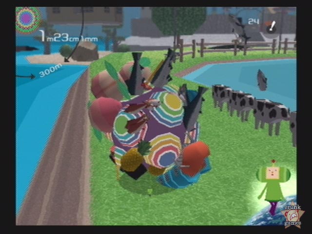
Katamari Damacy, Marx, collecting stuff and location-based applications

People interested in curious cultural mash-up might have a look at this critique Katamary Damacy using Marxist, Structural, and Jungian schools of criticism by Ryan Stancl. I was intrigued by the critique of stuff collection:

But why is there all this emphasis on collecting in Katamari Damacy?

Ignoring the surface fact that it extends gameplay, collecting stuff is something that is integral to people, especially children, especially this day and age. (...) Collecting is something that is innate in people, something that lasts an entire lifetime. It’s about the above, but also about having to gather together everything in one’s life, catalogue it, and organize it neatly, for in a world that is so chaotic, some order is welcome. Also, lately it’s about just hitting the right buttons in marketing to the consumer, hitting on that need to have everything, to ‘collect it all.’ (...) Whatever it is, this collecting facet in Katamari Damacy says a lot about our culture, which is what Marxists look for when interpreting a work of art.

Why do I blog this? collecting and finding stuff seems to be a recurent pattern in game-design; both in video games but also in pervasive games in which collection has been used to make people wander around in the physical environment (promising potential virtues like... meeting new people or discovering new places; unfortunately this failed but that's another story). The reason why I am blogging this is that I am always wondering about how to go beyond collecting (I'm tired of collective treasure hunts in location-based games), there must be a more original paradigm.

Insectopia: context-aware gaming

insectopia (developed by the Game studio, a lab of the Interactive Institute in Sweden) is a mobile phone game that rely on context-awareness:

insectopia is a new kind of cell phone game where the real world spills into the game world. Players roam the cityscape searching for and catching a multitude of different insects. Each insects in the game world is generated by using the available bluetooth devices available in the player's vicinity. By catching insects and trading them with other players, players build their own collection bigger and better. The current status of the game is displayed on various highscore lists both in the phones and online.

See also geoquiz, a location-based mobile game in which players create and answer questions related to their current geographic position (kept track of through the GSM network).

Why do I blog this? though both quite new, the design concepts (collect stuff, search for things in the vicinity, get questions at specific location) seems more and more simple to implement (given the quantity of games of that sort); whereas few years ago the seminal Mogi Mogi was heavier.

loc8tor

Via timo: the loc8tor:

Loc8tor uses a blend of exciting new technologies and traditional radio frequency (RF) technology. Both Tags and Handheld transmit and receive radio signals. The Loc8tor Handheld picks up this signal translating it in to clear audio and visual prompts to guide you in the right direction or warn that an item has gone astray. Audio beeps are also emitted by the Tag to help you home in on the items specific location.

Characteristics are quite interesting:

Up to 24 Tags can be monitored in Locate or Alert modes. Loc8tor has a maximum range of 183 metres / 600 feet. This is based upon an outdoor application with clear line of sight. Obstacles such as walls, floors, cupboards and other people will reduce the maximum range proportionately. The Handheld guides you to within 2.5cm / 1” of your possessions. Loc8tor is fully directional and will provide guidance left and right, and up and down.

Timo gives an excellent review of the system, framing it into an "ambient findability" concept:

In practice one attaches the tags to important objects by way of key fobs, adhesive backing or containment, and then name the tags one by one through the interface on the handheld finder. When you lose something, you press a button, select the thing you want to find and the unit starts bleeping: the intensity of the sound, and the bars on the screen are proportional to your proximity to the lost item. Because it’s directional, you can turn around slowly in a circle, and find an initial direction, then repeat this a few times and you normally find the thing you are looking for.

Where this product fails miserably is in the interface. The arrangement of buttons and screen menus shows a lack of thought or design process: they are inconsistent, badly labelled, overly hierarchical, highly modal and very prone to simple errors. (...) Given that the act of losing something – or remembering to take things with you – usually happens in moments of stress: walking out the door, gathering things from around you, getting off the train, this interface is overly complicated for its intended use.

Why do I blog this? because this tool is a - sort-of - weak signal of applications that may populate the Internet of Things, but why do we need yet another device for that matter?

What to do with geospatial traces

Yesterday, the FT had a very interesting piece about "geospatial traces" (i.e cell phones and GPS signals). It's called "Rome – as you’ve never seen it before" (by Richard Waters). The question the author address is the very recurrent "What if the location of all those devices could be pinpointed at any moment, showing where their owners were coming from or going to?". Drawing on the example of "Real Time Rome" (aggregating data from cell phones, buses and taxis in Rome to better understand urban dynamics in real time), the article describes potentials uses for geospatial data gathered from various sources. This can help to get some representations (why not by using mash-ups), of traffic flows or pedestrian movements. Eventually, showing those information could influence people's behavior as the author says or "be a goldmine" for urban planners".

This is of course related to the "social navigation" issue developed by Dourish and Chalmers in the paper "Running Out of Space: Models of Information Navigation">:

In social navigation, movement from one item to another is provoked as an artefact of the activity of another or a group of others. So, moving “towards” a cluster of other people, or selecting objects because others have been examining them would both be examples of social navigation.

Why do I blog this? since my research interest are related to how people use/benefit/infer things based on others' whereabouts, this article was interesting for different reasons. First, the fact that it's in a business newspaper is interesting from a foresight viewpoint (it means that this sort of ideas get closer to people's reality and is trendy even out of academic or artist circle). Second, it shows that that apart from the "social navigation" usage as well as the "goldmine for urban planners" there is nothing new under the sun. I'd be interested in more playful ideas: a simple one would be what Justin Hall proposed: "Passively multiplayer gaming" (see description below), using geospatial traces could be a way to improve MMO character or so...

At that point, turning your life into one of Hall’s passively multiplayer games is simply a matter of adding game logic. (...) Your ‘character’ could gain levels and skill points by checking e-mail, going to saxophone lessons, or writing a column for Gamasutra. Spam e-mails could be turned into enemy fire. Heck, the aforementioned cigarette break could help your friend poison a horde of aliens with toxic chemicals, if you wanted it to!

What else? of course the opposite of social navigation could be cool too (not going where the crowd goes...) but it's way too simplistic.