Locative Media

Urban Play and Locative Media Worksop in South Kora

INTERNATIONAL WORKSHOP ON 'URBAN PLAY AND LOCATIVE MEDIA' ORGANIZED BY ART CENTER NABI, SEOUL, KOREA (OCTOBER 18-20, 2005)

Emerging technologies such as wireless network, locative media, and pervasive computing have brought about new perceptions and social interactions in urban environment, transforming the ways we experience our cities. The concepts of space, time, and social relationship in urban environment are put in flux, while there are growing interests among communities of artists viewing city as social playground, public space, fluid canvas, and invisible layers of network.

Art Center Nabi is organizing an international workshop in partnership with the city of Seoul to initiate cultural and artistic projects exploring the theme of 'Urban Play and Locative Media.' On the cross platforms of art, design, technology, and social sciences, submissions are sought to deal with the issues of participation, play, process, and engagement in urban environment incorporating various locative and pervasive media technologies. We are looking for fresh and thought provoking insights and projects that are to reflect on but not limited to the critical issues as following:Â

  • How new communication media opens up new ways to engage people in public domain?
  • In what ways people participate and play in urban environment in dynamic formation of city?
  • What kind of urban games are possible using emerging technologies? And what kinds of collective 'vibes' can be generated through these games?
  • How can physical or virtual spaces in city be created, experienced and accessed by collaborative or competitive movement of people?
  • How can diverse aspects of city whether cultural, historical, social, or personal be reflected and shared through participatory gestures?
  • Â

  • How can disparate neighborhoods or different communities be linked, interact or confront in playful gestures?

NOKIA's Digidress

A 2002-2003 project at Nokia: Digidress by Per Persson, Younghee Jung, Jan Blom, Ionific. It's actually one of those matchmaking system that allows colocated people to be aware of relevant partners presence in the vicinity.

Mobile phones have traditionally been used to connect remote people. With Bluetooth, W-LAN and other short range radio technologies, mobile phones could also be used to connect proximite or co-located people. Mobile devices could exchange data with or without the users' immediate awareness. In an encounter between spatially proximate people, how can information in digital realm support and augment existing social behavior, practices and experiences taking place in real space?

DigiDress application allowed mobile users to create a page on their phone with text and imagery describing themselves, their interests, dreams, things they are proud of, favorite jokes or any other content. Pages were then viewable by other users within Bluetooth range (typically 10-20m), without the page owner's explicit consent. In this way, DigiDress users could take a 'peak view' at others without revealing their identity, similar to peaking at non-aqcuinated people in public spaces.

What is interesting is that they conducted user-testing:

DigiDress was provided to Nokia employees for user trial. The software was made available and users with compatible phones were invited to download and try it out. The DigiDress prototype was equipped with a logging functionality that enabled us to collect very detailed information about what features were used and how much. During the study we collected 46 DigiDresses which were later subjected to analysis. We also interviewed 10 of the most active DigiDress users.

During the trial period (89 days) 618 users installed DigiDress on their phones. The average use span was 25 days. The identity expressions created were both serious and playful, revealing and non-revealing. Factors influencing the identity expression included strategies for personal impression management, privacy concerns, and social feedback. The application was used with both acquainted and unacquainted people, and viewing the identity expression of people nearby was one major motivation for continued use. Direct communication features such as Bluetooth messages were not commonly adopted. In several instances, DigiDress acted as a facilitator for 'real' social interaction between previously unacquainted users. Privacy concerns and their alleviations, as well as use barriers, were identified.

Why do I blog this? even though I am not really convinced by this sort of application (due tu privacy concerns and the cost to enter the information to create the profile), I like the way this project reflects the design process; the architecture seems preytt light and the interface seems interesting.

Computer-generated directions sucks

The NYT has today a terrible piece about online mapping services failes to be a godsend for travelers.

Roughly 1 in 50 computer-generated directions is a dud, according to Doug Richardson, the executive director for the Association of American Geographers. He blames inaccurate road information for most of the failures. (...) "You have to have the latest data about road characteristics - things like one-way streets, turns and exits in your system in order for it to generate accurate directions," he said.

Even if the streets remained static, online mapping would be an inexact science. Most of the major Web sites draw their data from a small group of competing suppliers and update their maps quarterly. They use a process called geocoding, which assigns a latitude-longitude coordinate to an address, to find a destination. Then their systems calculate the most efficient route. Each site handles the data in a slightly different way, which is why search results vary from mapping site to mapping site.

Then, the article mentions few troubles:

"On Long Island, two nearby towns may have roads with the same name," she said. The sites do not draw a clear distinction, she added, "So it's easy to make a turn on the wrong one." (...) Her frustration recently boiled over when she queried three mapping sites for directions to LaGuardia Airport, and received three different sets of instructions. "Mapping sites give me a false sense of security," she said. "I don't trust them anymore." (...) Thanks to MapQuest, I've missed numerous business meetings in Washington. Recently, I clicked on MSN Maps and Directions to find the quickest way to an Italian restaurant in Orlando, Fla. It pointed the way to a quiet residential neighborhood but, alas, not to the pizza parlor I had in mind.

And when it comes to solutions, here is hwo it goes:

That doesn't mean you have to get lost. To improve your chances of making your next business meeting, consider buying a navigational computer that uses G.P.S. technology. Those systems constantly monitor your position and calculate the most efficient course. An old-fashioned atlas would help, too. Or you could do what Ms. Taub, the computer tutor, recently started doing. You could ask for directions.

Why do I blog this? well it's fantastic, again we have a technology complex to deploy (it's difficult to give a direction to the user when each city has same street names) and people now don't trust the system. What I find great here is the conclusion: the most efficient way to find your way is to ask someone. This is social navigation, the most common way to navigate through different space: physical space, information space... SocialNav starts from the idea that “when people need information, they will often turn to other people rather than use more formalised information artefacts” (e.g. asking people for advice when lost in a city instead of studying a map). Studies on how people followed crowd are also an influence (Follow the leader to bagage claim...). Would it be more relevant to design a navigation tool based on social navigation?

Location-Based Services: hard to become a mass phenomenon

The IHT has this morning a very relevant piece about Location-Based Services; not really research-oriented, it's rather focused on pragmatic and business examples which worth it. The paper puts forward the difficulty to throw LBS to the market:

Though cellular phone companies have been touting these location-based services for five years, the scenario above remains rare - so rare, in fact that some industry experts question whether the services will ever become a mass phenomenon. (...) "Location-based services have held great promise for a long time, but until now that promise has not been realized, and it's not clear that it ever will be," said Jeremy Green of Ovum, a consultancy in England. "It's a fantasy to think people will shell out money for these services. You do lots of clicks, go through lots of menus, and then you get a not-so-good map directing you somewhere." (...) "For any new service to be successful, no matter what it is, it can't require a whole new way of thinking," Hyers said. "MP3 players have become popular because they followed in the footsteps of the Walkman, which for the past 25 years has gotten people used to listening to portable music."

That's definetely true, there is an unbalanced relationship between the promising idea of location-awarenes and the poor interface we have. What strikes me in the LBS world is the lack of interesting and relevant scenarios easy-to-deploy on mobiles devices. The "let-me-find-the-closest-and-bestestest-restaurant" or the "where-is-my-friend-Joe-in-the-vicinity" are nor very imaginative.

The paper also presents how it would work on mobile devices (through GPS/WiFi with SkyHook or Ekahau/GSM). There is a good emphasis on positioning with WiFi (it's very trendy lately but it exists for a long time, I don't know why there is a burst about this, people are just aware of it now or maybe it's because there are start-ups working on it)

Why do I blog this? I think the paper summarized pretty well the situation we have: lots of technologies to do positioning but poor scenarios of use. It' always the same story: tracking stuff, find restaurant and locate things. Come on! there are more interesting projects (see for instance the physical wikipedia or familiar stranger which is one of my favorite locative media project: I like this "ambient awareneness tool" to enhance the confort in space)

Share location-annotations with placeshare.org

(via the geowanking mailing-list), a new website to "enable people to share location content": placeshare.org

The goal of PlaceShare is to enable people to easily store information about places and share that information with everyone. The best way to start is to check out the examples or start by creating your own places. PlaceShare supports locations throughout the world. PlaceShare uses the google maps to display locations.

Each location you enter in PlaceShare can be associated with one or more tags like home, "secretbases", "funky_coffee_shops", or whatever else you can dream up. You can also create maps which group together a number of places.

Placeshare allows you to keep your information private if you wish. A couple examples:

  • Add the cool places you have visited on vacation
  • your favorite restaurants, shops, museums, etc

Using the tool is simple:

The way it works is that you enter places via street address or latitude and longitude and then tag the location. Users can then search for other peoples locations based on the tags. The results are displayed via google maps. The site is in beta stage at this point so you will likely see some bugs

Why do I blog this? this kind of project is mixing tagging and user-authored location annotations � la urban tapestries. I would be interested into how the tagging system will evolve and user will make use of it (as in Mauro's project, but with placeshare it's not meant to be used on a mobile device). Another interesting trick here is the the use of google maps for the display of messages. Connected pasta: here I mentioned the applications developed by Fab at our lab about this topic. For those who don't get why would we want to annotate map locations, just read this. Also people interested into how to annotate google maps may have a look here.

See virtual and public dimensions through your mobile phone

(via), a new locative media project called Rixome, "is a network and a tool that turns mobile screens into windows that show the virtual and public dimensions of our point of view":

Words and phrases crossing rooms and streets. Gestures and drawings entangled between the virtual and the material in walls and squares. Songs and narrations guiding us througth the spaces where we coexist. Psicogeographic documentaries, testimonies of an old woman on the window where she looks her city for years. All the Globe is now our canvas, our white page.

rixome is a dimension for virtual and open publication in physical places. The creations in this network join the anxious landscapes of our cities making up a new public memory, an exchange environment where our trace always lasts.

Why do I blog this? yet another locative media project, connect to psychogeaography and situationist stuff!

"Situating Ubiquitous Computing in Everyday Life" Workshop at Ubicomp

A workshop I did notice at Ubicomp 2005: "Situating Ubiquitous Computing in Everyday Life: Bridging the Social and Technical Divide":

A workshop to be held at UbiComp 2005, Tokyo, Japan, 11 September 2005. Sponsored by the Knowledge Acquisition & Projection Lab @ Indiana University. Organized by Michael A. Evans, Andy Crabtree, Mike Fraser, Peter Tolmie and Rick McMullen

Submission Deadline (Extended): 18 July 2005 Acceptance Notification: 25 July 2005 Final Version: 8 August 2005 Workshop Date: 11 September 2005

*Call for Position Papers* The most profound technologies are those that disappear. They weave themselves into the fabric of everyday life until they are indistinguishable from it.” (Mark Weiser, "The Computer for the Twenty–First Century")

If we take Weiser’s vision seriously, then it is clear that the ultimate challenge for ubiquitous computing is to weave or situate new technologies into the very fabric of everyday life. Despite a number of impressive efforts developing and evaluating prototype systems, many researchers will no doubt recognize that UbiComp demonstrations are nevertheless very 'distinguishable’. Such systems have yet to disappear or become an ‘unremarkable’ feature of everyday life - this, we suggest, largely being a result of where emphasis is placed in the development of ubiquitous computing systems. Although attempts have been made to understand he ‘fabric of everyday life’ of target users, emphasis to date has primarily been placed on demonstrating theoretical principles from computer science and the capabilities of new ubiquitous technologies. Given the nascent state of the field, this has been an understandable first phase of growth. Nonetheless, with the movement of computing research away from the workplace and its diversification into novel areas of everyday life, the time is ripe for serious reflection on the nature of everyday life and its importance to the ongoing development of ubiquitous computing systems.

Further details: www.pervasive.iu.edu/~kapl/ubicomp2005/

Why do I blog this? I think this workshop raised an important question often forgotten: how can ubicomp be situated in everyday life. That's a tremendous issue: how can we engage users in using these technologies. That should indeed fits with their activities/habits/expectations/desire... easy to say but how do we actually do that?

Location-Aware systems evaluation

Thank you Philip for pointing me on this relevant research paper: Deploying and evaluating a location-aware system (by R. K. Harle and A. Hopper from University of Cambridge, UK), International Conference On Mobile Systems, Applications And Services,Proceedings of the 3rd international conference on Mobile systems, applications, and services (2005)

Location-aware systems are typically deployed on a small scale and evaluated technically, in terms of absolute errors. In this paper, the authors present their experience of deploying an indoor location system (the Bat system) over a larger area and running it for a period exceeding two years.A number of technical considerations are highlighted: a need to consider aesthetics throughout deployment, the disadvantages of specialising sensors for location only, the need for autonomous maintenance of the computational world model, the dangers in coinciding physical and symbolic boundaries, the need to design for space usage rather than space and the need to incorporate feed-back mechanisms and power management. An evaluation of long term user experiences is presented, derived from a survey, logged usage data, and empirical observations. Statistically, it is found that 35% wear their Bat daily, 35% characterise their Bat as useful, privacy concerns are rare for almost 90% of users, and users cite the introduction of more applications and the adoption of the system by other users as their chief incentives to be tracked.Thia paper aims to highlight the need to evaluate large-scale deployments of such systems both technically and through user studies.

Why do I blog this? another reference in my literature review about evaluating the use of location-aware technologies! There is now a certain amount of paper about it, I should put all of this into a more formal paper with the emerging patterns. What I like in this reference is the "ong term user experiences" evaluation as well the use of mix data: surveys, logged usage data, and empirical observations.

A wikipedia for the physical world, based on location-based technologies

(via): some folks envisions a location-based wikipedia: Russel Buckley at the Mobile Technology Weblog proposed A Manifesto for Taking Wikipedia into the Physical World:

One of the most exciting things that's going to happen in the next 10 years, in my view, is that the Wikipedia will move into the physical world. It may not be a Wikipedia initiative (ie it might be a new and different organisation that makes it happen), but the principles will transfer and apply.

Let's look at how this might work.

You're in London and are standing in a pleasant, sunny street in Camden Town. City life is going on around you and you fancy the idea of knowing a little more about where you are right now.

Using your phone, as if it was a PC mouse, you uncover snippets of information from the world around you. You click on an old house in the road and a wealth of digital information comes onto your phone screen. Some contain video and audio links.

You learn that the house is on the site of one lived in by Charles Dickens' wife after their separation. You're interested in Dickens so you poll the area and find that there's actually a tour of Dicken's Camden Town that afternoon.

Out of curiosity, you look up how much this kind of house would be worth, what local rates and taxes are. And you read a review of a local citizen's view of schools in the area.

Moving on you see a tree, which looks unusual and casually click on it to reveal its genus. Then you click on car you like the look of, to find out how much it would cost second hand (2003 model), where you might be able to find one and what the gas consumption is like.

As stated by WorldChanging,:

He's essentially arguing for an open urban informatics model, one combining camera phone networks, virtual tags and location-based services. What makes his argument novel is that it makes the wiki concept central to the model -- anyone can annotate, update and edit.

Why do I blog this? I think it's an interesting step forward the integration of various sources of information to build a bottom-up physical-space augmentation. Besides the cost of implementing it is not so touggh, relying on today's technologies.

How Mogi-Mogi has been developed

If you happen to read french, there is a must-read today: Les NTIC comme architectures de la rencontre pour une société d'individus: Le cas du développement d'un jeu de rôle mobile-internet basé sur la géo-localisation des terminaux (ICTs and the engineering of encounters: A case study of the development of a mobile game based on the geolocation of terminals) by Christian Licoppe et Romain Guillot (France Telecom R&D).

It's actually a study carried out by researchers at France Telecom about how french company Newt Games imagined its next game, a mobile multi-user role palying game, which has to be scaled down into something simpler: Mogi Mogi (more information about the game in Feature).

Anchored into sociological (as well as socio-cognitive theories � la Kirsh, Norman, Suchman), the paper explores how a game at first targeted to the specific mobile game fans turned out to be accessible to everybody (ranging from simple users to hardcore gamers) and that can support encountering/matchmaking. The most interesting part (with regard to my interest, no offense for the writers) is simply the description of the game development process. Of course, in this paper, the name of the developers/company is not cited, nor the name of the game but it's easy to guess that it's Mogi Mogi (based on various cues: a snapshot!!!!, partnership with KDDI, link with Innovacell).

The very interesting point in this paper is how the mobile game developer reshuffled their project due to various constraints (technology, market, financial pressure, management, critics by game editor Ubi Soft).

There is actually an english version of this paper, presented at Mobile Leisure and the Technological Mediascape (Manchester, 2005): ICTs and the engineering of encounters: A case study of the development of a mobile game based on the geolocation of terminals:

By means of tests and user feedback, designers initially oriented towards the concept of a multi-player role playing game for mobile phones, targeted towards a specific audience, will shift their design strategy. They will gradually grasp the potential represented by the possibility of users “seeing” their mutual positions on mobile screens in order to enter into contact with one another. Their design work will focus on the engineering of encounters, through an innovative geolocalised service which is now oriented towards any mobile phone user (and not only gamers) – a generic device that anyone could use in principle. The design trajectory moves away from the development of a highly scripted, distinctive game towards the development of a generic information and communication technology.

Since the services they design are based on location tracking, they are particularly interesting from a sociological standpoint. Geolocation embeds issues of space and place directly into the engineering of mediated encounters. Up to now, electronic encounters were a characteristic feature of Internet world, i.e. in situations where actors use a connected personal computer. The development of mobile technology actually introduces original possibilities of exploiting cell phone tracking (in wireless network or through satellite positioning) to engineer disembodied meetings “on screens”. Since mobile phones almost always accompany their owners as they move about, a geographic position (that of their “geolocated” terminal) can be associated with personal electronic identities. The mobile phone screen may become a map of the cityscape, and icons or avatars represent the location of the players that move in it.

‘George Square’ collaborative tourism system

George Square:

‘George Square’ collaborative tourism system. This system uses a small, portable tablet PC to allow a mobile visitor to explore a city while sharing their voice, location, photographs and web pages with others. This tablet is connected via the Internet to other users running the same software who may either be co-present or in different parts of the city.

Described in Sharing the square: collaborative leisure in the city streets by Barry Brown, Matthew Chalmers, Marek Bell, Ian MacColl, Malcolm Hall, Paul Rudman, To appear in Proc. Euro. Conf. Computer Supported Collaborative Work (ECSCW) 2005, Paris.

[Authors] ran an extensive trial of the system in George Square in Glasgow, studying how the system could support shared visits. In this trial one visitor walked around the square looking at different attractions in the square, while a second visitor was sat indoors at a laptop computer. Both visitors could communicate through our system, talking, taking photographs and browsing the web. (...) In these trials the map was used as a resource for understanding the context of others, photographs were a resource for conversation between users and the recommendations supported talk about the different places in the square. Importantly, the system provided not only support for collaboration, but also for the sociable activities of a visit, such as talking around photographs and city features. (...) One of the main issues which hampers the deployment of such system is the difficulty in creating recommendations and marking areas. We have thus developed a GSQ editor which allows the authoring of recommendations (buildings, urls and pictures). Both location and view volume corresponding to a particular picture can be edited. To further help with marking areas, we suggest regions on the map by retrieving nearby physical features from a repository of real map features (OS Mastermap). We have extended the George Square system to apply visibility processing to prioritize recommendation that are probably visible to the user. By using information about real world buildings and features, the certainty that a particular recommendations is visible is computed. This in turn is used to provide a filtered recommendation service which has the benefit of presenting location and context sensitive information.

Why do I blog this Another location-based service devoted to tourism. However it's rather experimental than meant to be marketed. I like the annotation and marking feature as well as the visibiliy filtering capabilities.

Object oriented locative media: asphalt quality for skates

(via) geoskating seems to be a compelling project. As described by Just van den Broecke (his author) "GeoSkating in short is about automatic map generation through GPS/mobile combined with real-time location-tagged media and live tracking.".

GeoSkating aims to automate the generation of interactive, multimedial skate-maps by using the Global Positioning System (GPS), Mobile Phones and the Internet. The key idea is that while skating, GPS position data is being assembled and published to a server through a mobile phone. At the same time the skater can enrich the GPS data with road surface ratings and by submitting media items (pictures, videos). The server will draw geographic maps showing road quality through colouring plus the submitted media on the GPS locations where they were captured. In addition, skaters can also be seen moving in real-time on the map while skating!

Check the website, it's possible to participate! Why do I blog this? just another locative media which I found relevant. I like the "asphalt rating", it's very pertinent. This makes me think about Jyri Engestrom's object-oriented social software: this geoskating is a kind of "object-oriented locative media" in which the object rely on what the author defines as:

Key questions for long-distance inline skaters are: Where can I skate and How is the road quality ? Common geographic maps do not show details like asphalt quality.

Blending GPS positioning and Wi-Fi positioning together into one system

AlwaysOnGPS is a technology that successfully blends GPS positioning and Wi-Fi positioning together into one system:

When GPS signals are available, our software uses them to construct a map of the Wi-Fi of landscape around you. When GPS signals are lost or dropped (which occurs frequently in big cities, indoors, etc...) this WiFI map provides accurate Geo-positioning information for all your GPS based programs -- all the time and in every situation.

Try it on your pocketPC, there's a 30-day free trial here. An when one of the company engineers escaped for lunch:

Julian Bleecker about Location Based Services

There is a great post by Julian Bleecker on O'reillynet.com: A Design Approach for the Geospatial Web. The article summarizes the approach taken by the USC School of Cinema-TV's Interactive Media Division and the Mobile Media Lab to designed location-based experiences. Some excerpts of Julian's claim I appreciated:

This is where the concept of location awareness comes into play. Like most context design models, location awareness focuses on a user-centered perspective. More than simply knowing latitude and longitude, location awareness is meant to consider more subjective aspects of LBS design, such as: with what activity is an individual engaged? Are they looking to find how to get from point A to point B, or are they wandering about, engaged in social activities, or on a shopping excursion? (...) Finding one's location and mapping (and now route-finding) represent, respectively, first- and second-generation GPS applications. Location-based services that approach their designs with location awareness in mind will represent the third generation of locative applications. Of course, GPS will be used in this third generation, but it won't be up front and center in the design. Instead, GPS will enable location-aware designs that require location, proximity, and movement to be components of the application design.

Read the article it's plenty of other interesting dimensions.

New Scientist about Location-Based Games

Science E-Zine New Scientist has a good piece of location-based games: Gamers turn cities into a battleground. The article summarizes the best-known project such as "Uncle Roy..." or "Pac-Manhattan", "Digital Street Games" and the game designed by It's Alive. It also describes next avenues. Some exerpts:

While many of the first real-world games involved using separate GPS receivers and handheld computers, mobile phones and PDAs that integrate such technology are catching up. "There's an evolution using the mobility of the phone to create completely new gaming experiences," says Tom Söderlund, who worked as a games producer for Swedish games company It's Alive, based in Stockholm. "I think we are going to see more and more games that blend with our real lives."

Definitely, instead of transposing console games to mobile devices, the crux point here is to take advantage of the handheld features (mobility, voice, positioning...) to design innovative game scenarios.

The end of the paper is the msot interesting since it describes what's next, focusing on Gizmondo's plan:

Games console makers are also embracing the trend. Portable console maker Gizmondo is soon to launch Colors, a gangland game where players play a conventional arcade game to earn credits and money. These are then used to buy turf in the real world - Soho in London, say. Walk into a Soho cafe and attempt to play Colors, and the GPS embedded in the console might tell you you're playing on another gang's patch, and you need to beat them in a virtual fight to claim the turf and continue.

The company has even bigger plans, developing a game that exploits a digital camera already built into the console. Virtual creatures live at specific GPS coordinates, and when a player views the location through the camera they will see the real world with a three-dimensional animated digital creature laid over the scene.

Finally, it points the many problems that arise with these location-based games:

For some games to work, you need a quorum of players. "If I'm a good terminator trying to find a bad terminator to fight, and the only bad one lives in Sweden, then I'm not going to see much action,"

And in Uncle Roy, for example, not only does the game involve innocent bystanders - the woman dressed in black who Matt followed had no knowledge she was taking part in the exercise - but it culminates in the street player climbing into a stranger's car, which means the player has to trust the organisers.

game designers face the challenge of how to preclude "cyber-stalking", and protect the safety of the public and players, especially children, who might wander into unsafe situations or places.

A very interesting summary of what's going on lately!

Place Mail: location-based to-do list for GPS cellphones

(via and iconoculture), another kind of location-based service: location-based reminders:

Keeping track of multitasking, multi-tracked lives can be more than most can bear. A device that helps people be mindful – while they’re in the area – can save time and personal frustration.

Navigation? Try nag-ivation. Developed by Minnesota grad student Pam Ludford, Place Mail is a location-sensitive to-do list that works with GPS-equipped cellphones to help people stay on top of their errands and aware of their surroundings (Linden Hills News 5.05). The application lets users (and their friends and families) send themselves wireless reminders to be received at specified dates, times, and locations.

Say buh-bye to drive-bys. No more forehead-slappin’ “duh’s” after mindlessly cruising past the mini-mall. Not when Place Mail can beep in a reminder: “Return DVDs.” Place Mail post-its can also be more supportive: Boyfriend facing a killer presentation? Schedule a “good luck” message to pop up beforehand. Place Mail is now beta-testing with a variety of Minneapolis-based, self-confessed multitaskers.

Yep, why not?

SmartRunner: your GPS path while jogging

SmartRunner is a interesting tool:

Up to now, it was only possible to be informed about speed and covered distance of a workout session at a fitness studio or using an exercise machine at home. But what about jogging in unobstructed nature? Any guidance is missing. What distance did I cover? How many kilometres did I run? What was my speed? How is my training condition and how did it change during the last month? Without such information you lose impulse, because you are not able to meter, evaluate, and compare your athletic success.

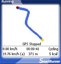
We developed a software, which makes it possible to do sport everywhere and anytime – in unobstructed nature – while being informed about specific measured values of the workout session, like:

  • duration of the workout session
  • covered distance in kilometres
  • current speed
  • average speed
  • estimated calorie consumption
  • graph of the covered distance

Our location based application research

We just finished a document that shortly summarizes our research projects about location-based services at Craft. It can be downloaded here (pdf, 909kb).

The 4-pages document gives an overview of CatchBob!, Shoutspace and Stamps. It also presents few results about CatchBob! as well as the issue we have to dealt with while designing those applications.

It's not intended to be read by academics; we just did it as a teaser that explains to non-scholars persons interested by our projects.

Trazes: your path on Plazes

Plazes has a new interesting feature: it displays your Plazes history on a world map.

Trazes allows you to track your historical whereabouts and display the Trazes you left on the globe on a flash based map (thanks, bryan boyer aka IndyJunior). All you need to do is activate "Trazes" in your profile. You will then be presented with the map for the last 30, 60, 90 or 365 days. If the tracking is newly activated, only Plazes you discovered will be taken into account.

Since I did not travel overseas it sucks, so you have to click on the little arrow on the bottom left-hand corner, and you won't have a nice readable map when zooming.

Why do I blog this? I'm into location-based applications. This feature is nice and the fact that you have XML fils of your position history is interesting. Of course it disrupts my privacy but... It actually used a feature I already mentionned here.

PLAN TECHNOLOGY CAMP

Next OPEN PLAN event: PLAN TECHNOLOGY CAMP Venue: Mixed Reality Lab, University of Nottingham Date: Sunday 2 October to Saturday 8 October 2005 Deadline for Expressions of Interest: Monday 4 July 2005

Cross-disciplinary teams will be formed to work on seed project ideas and develop methodologies, encouraging cross disciplinaryexperimentation. Proposals may develop into real projects or may be entirely hypothetical. There will be opportunities to take the projects further, in particular as part of the PLAN final exhibition at Futuresonic 2006 in Manchester UK during July 2006.

Please send a 2-page expression of interest, including details of your areas of interest, experience and expertise to the address below by Monday 4 July 2005. Suggestions for seed ideas in the area of locative-based media are also welcomed. Places at the workshop are limited and the steering committee reserves the right to seed ideas and put together diverse teams from the best submissions, based on the expressions of interest together with views generated at the ICA Event.

Why do I blog this? because it's part of my locative media research watch, after the first plan event this part seems event more appealing with hands-on activities.